C
u r r e n t C o m p u t e r M o d e l s -
F o r e c a s t s
(please REFRESH for latest graphics)

Computer
Models |
|
Latest talk is saying that the GEFS Ensemble (ex-GFS) might just be the best accuracy this year. Greatest accuracy was the ECMWF,an EU group. It's been the best since 2006 and I tend to the GEFS and ECMWF as two main indicators. See both below. Other models include the GFDL and HWRF. The "Official" forecast cone/track is usually an average of the model runs with weight given to above. NEW The best Computer Model Run Track Animations - Press PLAY button within ECMWF
• GEFS
GLOBAL • GFS
GLOBAL |

*ECMWF is ORANGE TRIANGLE

3 & 5 Day
Tracking Cone
NHC NAVY


STORM KEY MESSAGES

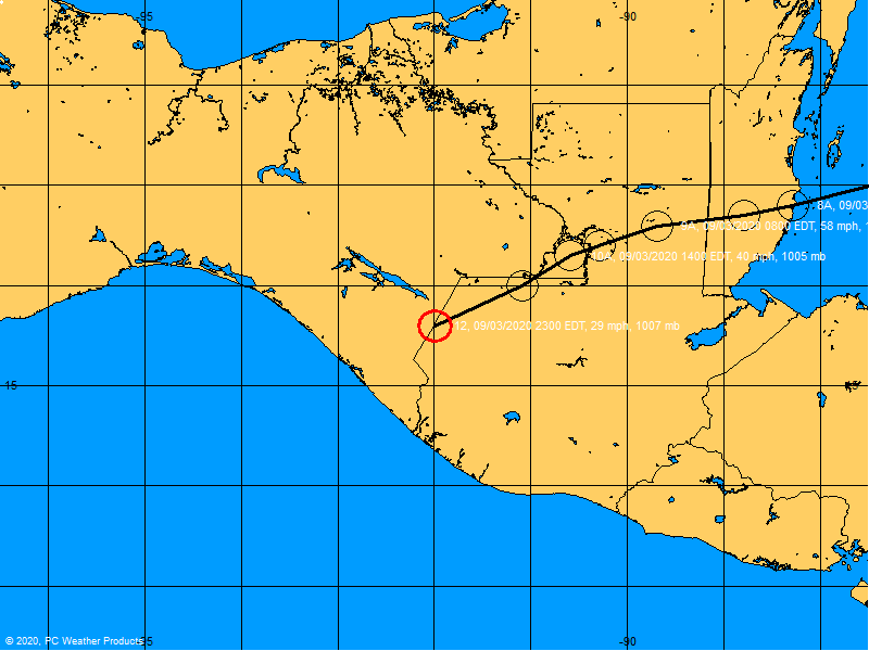
Storm Centered Wind Diagram

Wind Speed Probabilities

Tropical Force Wind Arrival Times

Wind Path Estimate ~ Strength
SAT View Precip
Rainfall Potential


Flash Flood Potential

 |
If
formations are circled & numbered,
please click
graphic for explanation |
|


Return to WEATHER
INDEX
i-vol.com